Colorado Wildfires Rage Out of Control: Here is a Mapping of The Wildfires for the Past Few Days
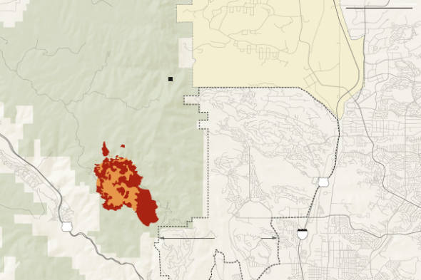
Things are heating up and getting really hectic in Colorado. Wild fires continue to rage and threaten thousand of homes and families. The mapping of the fire near Pikes Peak and it’s spread per day is shown below. In addition a few small fires near Boulder Colorado have also sprung up in the past few days. Colorado is now in Danger North, South and West. We are hoping for some more heavy rain to come our way soon to help with the fire fighting efforts. Several groups are holding minor and major charity events to help supply food, water and supplies to the families that have been displaced. We are also taking donations to help efforts. You can write in your own amount for even as little as $1 US.
![]()
The huge fire now threatens the City of Colorado Springs
On The Other End of Colorado, Boulder is also fighting a much smaller fire near Colorado University Boulder Campus
June 23
The fire began in a remote area near Pikes Peak called Waldo Canyon, and burned vigorously. As a precaution, 11,000 residents of Manitou Springs, Cascade, Chipita Park and Green Mountain Falls were evacuated.
Picture of the heat signatures and fire spread on June 23rd 2012
June 24
On Sunday, the Waldo Canyon fire burned down the slope toward Fountain Creek and U.S. Highway 24, threatening buildings in the town of Cascade at the foot of Pikes Peak. Residents of Manitou Springs were allowed to return to their homes.
Picture of the heat signatures and fire spread on June 24th 2012
June 25
Fire burned in a narrow path northward toward Rampart Reservoir. But on its southeast flank, it also moved toward a gated community near the Garden of the Gods, and 6,000 people are evacuated.
Picture of the heat signatures and fire spread on June 25th 2012
June 26
On Tuesday, the Waldo Canyon fire doubled in size to 24 square miles, and raced east toward Colorado Springs. The entire northwest section of the city was evacuated, some 32,000 residents. Dozens of homes were destroyed in Mountain Shadows. The Flying W Ranch, a historic banquet hall, burned to the ground.
Picture of the heat signatures and fire spread on June 26th 2012
June 27
On Wednesday, the fire was burning on the southwest corner of the Air Force Academy. Rain began to fall in the residential areas, but with it also come some stronger winds and lightning that hampered firefighters.
To help with the efforts you can find several charities including Red Cross to make donations to.
- Map image of the Colorado Fires and Their Spread By June 27th
- DJ Emir Email
You can also send anything you can to help relieve efforts by making a donation through us through our paypal account even donating as little as $1 You can send donations to

![]()


